FieldView instant data system is farming game-changer
Digital technology is already changing agriculture around the world with tools like Climate FieldView.

Posted 6 years ago
11/02/2020
Digital technology is already changing agriculture around the world with tools like Climate FieldView.
Digital technology and tools will potentially drive bigger changes on farm than mechanisation and synthetic chemistry brought the previous two farming generations.
It’s a bold statement, but one that Sam Eathington, chief science officer for Climate Corporation, the digital farming arm of Bayer, believes will become reality.
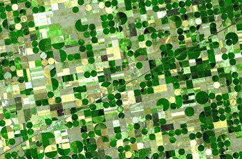
“Farmers around the world have to deal with a lot of variability. For example, comparing yield maps from a wheat field in Germany, a soya bean field in Brazil or a corn field from the US, all have areas of higher productivity and lower productivity. It’s an issue no matter what crop you are in or how big your operation is,” he says.
“But now it’s your opportunity. In the past we farmed using a constant rate across the field, whether it was seed rate, fertiliser or fungicide, but clearly our output was quite variable.
“Now we can manage that field metre by metre, and apply the right amount in each part of the field based on what it needs. But to do that we need a lot of data.”
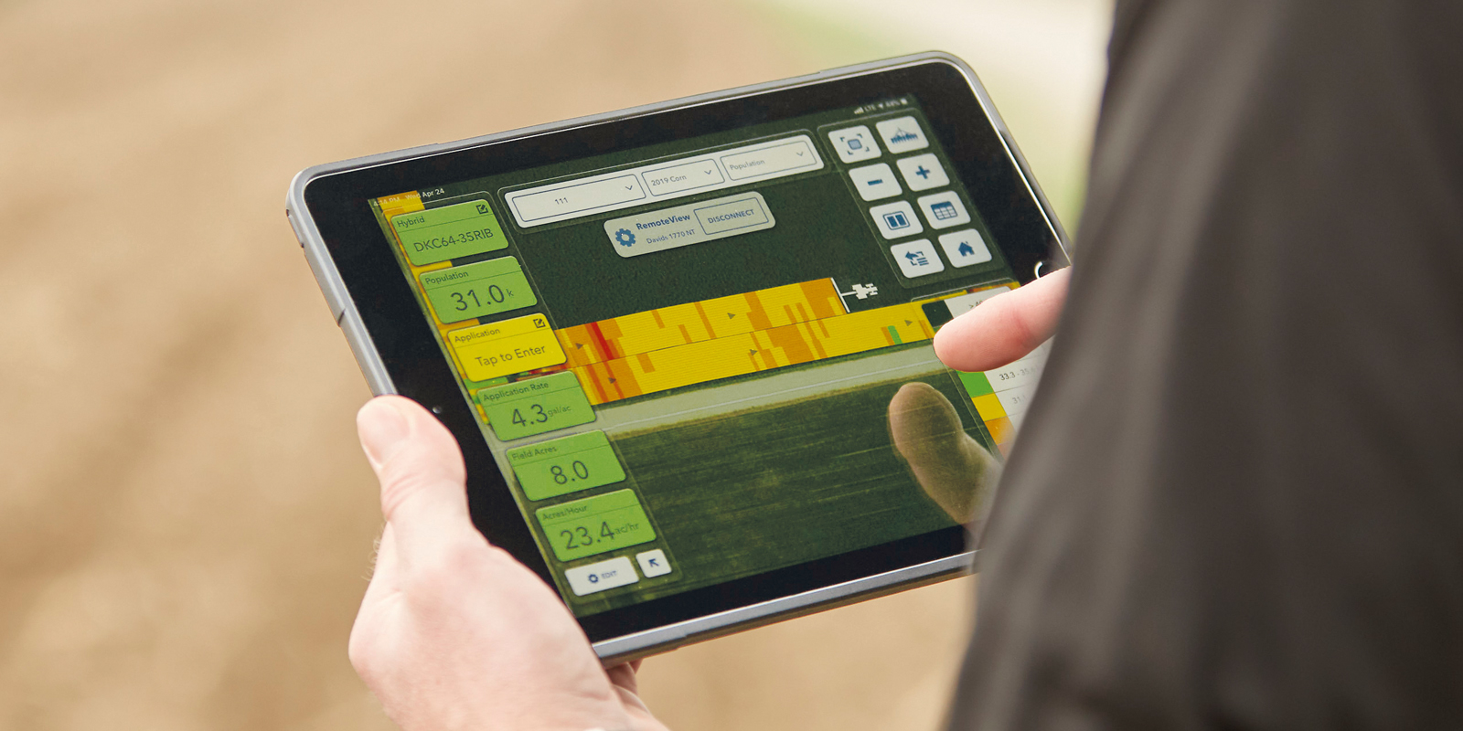
That’s where Climate’s FieldView Drive comes in. It is a wireless device that plugs into a machine’s diagnostic port and logs data such as machine location, speed and RPM. It can also record information about the field operation, such as seed rates, variety planted or crop yield and moisture content. The data is instantly viewable on an iPad using the FieldView software, creating real-time, spatial maps of what is happening in the field.
Furthermore, it also makes it easy to transfer historical data into the FieldView system.
“We’ve made it easy for farmers to assemble all their data and bring it together. This is the future of farming, where data and data science is helping to inform farming operations.”
The farmers’ data is combined with data from Bayer’s R&D on its varieties and crop protection products, and turned into actionable insights, Mr Eathington says.
“The era of pretty pictures – here’s a map or image of your field – those days are done. Farmers want action; what can I do with this, what does it teach me, what should I change in my operation? And figuring out what to do is what we are doing with techniques like machine learning and other deep learning algorithms. The journey is only just starting.”
In the US, where Climate FieldView was used on around 90 million acres in 2019, it is already turning into tools like Seed Advisor, which predicts which variety will perform best on a particular field.
“In two years of field-scale trials with farmers using their own equipment, the Seed Advisor choice yielded 0.5t/ha more than the comparison. And that’s just one decision, there are many more that can be impacted positively through data science,” Mr Eathington says.
“These tools will allow us to fundamentally change how we manage inputs, how we use water, fertilise or the land itself.
“On my family’s farm there are parts of fields where nine out of 10 years we never make money. That land should be doing something else, in habitat or preserving water quality, for example. Those are the things that get unlocked with data, and help farmers maximise their return on investment.”
In the UK, the Climate FieldView journey started last harvest, when eight FieldView Drives were trialled on farm. The initial reception has been extremely positive. “It’s just so easy to use,” says Kieran Walsh, an independent agronomist for Velcourt Advisory Services in southern England.
He had already been testing the FieldView software by importing yield maps from other sources, before trying out the wireless drive. The system also gives access to in-season satellite imagery allowing him to evaluate crop health.
“It’s been good to see the progression of FieldView in the UK. I have been using the US version for a few years, on and off. It’s given me a heads up of the benefits of the platform before using the drive on a client’s farm.
“The crop water usage map intrigued me, for example. After detailed ground truthing on wheat crops and reviewing weather data, after a prolonged drought in the spring of 2018 I was able to look back at that data, and see when the wheat quality disappeared. The water usage and the NDVI maps did correspond with the areas of wheat that were affected.”
Having all that information in one platform which is easy to use is helpful, but FieldView really came alive though last season, when he was able to combine it with the Drive that fits into the tractor or combine diagnostic port.
“It means I could see real-time information, accessing yield maps while the customer is still combining, giving me instant crop data. This is valuable as it saves time allowing me to gather crop yields from multiple farms all at once, rather than at the end of harvest when it has already become historical data.”
In future, further efficiencies may be possible, when in theory it should be possible to seamlessly put that data into crop recording software, saving time, improving recording accuracy and reducing paperwork.
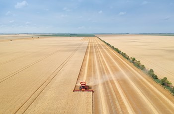
For farmers there will be other benefits, he suggests. “Many farms haven’t got access to a weighbridge for every load into their stores, for example. As soon as the combine is calibrated, it helps give some accuracy to yield totals for each field, which is more accurate than estimating based on trailer loads.”
Further ahead, there is potential to revolutionise agronomic decision making, he believes. “For example, linking in-field sensors to FieldView, having live nutrition or moisture readings would be a game-changer.”
Sign up here to see if you are eligible for a year’s free trial of FieldView™